|
| *****SWAAG_ID***** | 386 |
| Date Entered | 06/12/2011 |
| Updated on | 15/02/2012 |
| Recorded by | Tim Laurie |
| Category | Fungus / Mould |
| Record Type | Botanical HER |
| Site Access | Public Access Land |
| Record Date | 17/10/2011 |
| Location | Birkdale Common |
| Civil Parish | Muker |
| Brit. National Grid | NY 80 02 |
| Altitude | 630m |
| Geology | Peat over Namurian sandstones |
| Record Name | MUK020 Birkdale Common.Mallerstang Edge. Unidentified slime mould on ling at 630m AOD |
| Record Description | This slime mould could be related to the common DogsVomit or Scrambled Egg Fungus which is fairly common in Swaledale associated with decaying wood.
However this was photographed in October on Heather at 630m Elevation on Mallerstang Edge. |
| Geographical area | Upper Swaledale |
| Additional Notes | Note that the heather was in flower bud on 14 October 2011 at 630m AOD. |
| Image 1 ID | 1599 Click image to enlarge |
| Image 1 Description | Dogs Vomit Slime Mould or similar on heather with flower buds on 14 Octobber 2011 at 630m AOD. | 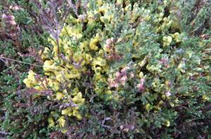 |
| Image 2 ID | 1598 Click image to enlarge |
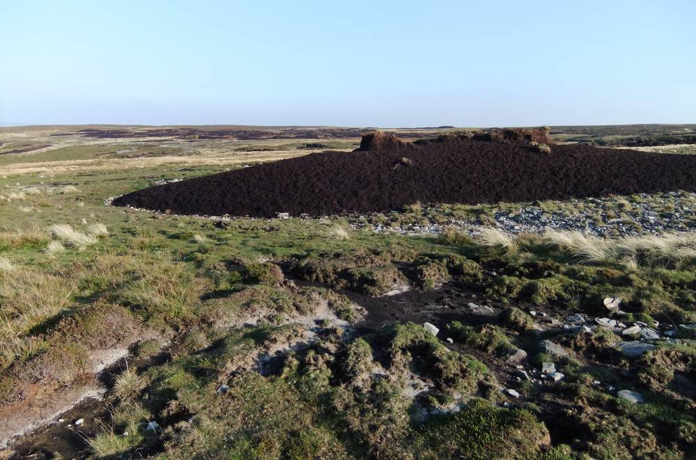
| Image 2 Description | Islands of eroding peat. Mallerstang Edge. |  |